 (About 530KB, 1720x1140)
 Go to: Top, or pictures of: Flowers, Foods, Hotel Scenes, Kodaikkanal, Kolkata - January 2005, Madurai, Ooty (Coonoor, Udagamandalam and Mudamalai), Vellore - November and December 2004, Various Maps , Shops , MIS ICON at Kovai Medical Center Hospital, Traffic and such,
[Snapshot of coimb-city.jpg] Coimbatore city, big -  (About 530KB, 1720x1140)
On this and the following city map of Coimbatore, the pink postit at top right marked KMCH is fairly close to Kovai Medical Centre Hospital. The line on the postit at bottom center marked "1 km" is about 1.5 km south of the Surya International Hotel (marked R15, near the northwest corner of the oval Race Course Road), and 2 km south of The Residency Hotel (marked R3, at right side of "Police Recruiting School" legend) on Avanasi Road. The map is rotated slightly clockwise of north. For example, Dr. Nanjappa Road along the west side of the Central Jail block points north.
[Snapshot of coimb-city2.jpg] Coimbatore city, small -  (About 115KB, 800x530)
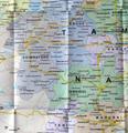
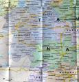
[Snapshot of coimb-area.jpg] Coimbatore area, big -  (About 490KB, 1240x1300)
Coimbatore is at the road and railroad junction in upper left quadrant of this and the following map; Madurai is in the far bottom right corner. At far upper left corner is Udagamandalam (Ooti, Ooty) . Top Slip is south from Coimbatore through Pollachi, then a little to the southwest. Kodaikkanal (also Kodaikanal and other spellings) is southeast from Pollachi, south of Palani.
[Snapshot of coimb-area2.jpg] Coimbatore area, small -  (About 150KB, 640x670)
[Snapshot of southtipb.jpg] India's southern 5°, good-sized -  (About 1200KB, 3020x2400)
This map and the following smaller versions of it show the southern tip of India, from Kanniyakumari about 8° north of the equator, up to Bangalore and Chennai at about 13°N. A table of latitudes and longitudes (Coimbatore: 11.0N 77.0E, Kodaikkanal: 10.1N 77.3E, Chennai: 13.0N 80.2E, Madurai: 9.6N 78.1E, Vellore: 12.6N 79.1E) also appears. See the coordinates.htm webpage for other Tamil Nadu coordinates.
[Snapshot of southtipc.jpg] India's southern 5°, big -  (About 320KB, 1500x1200)
[Snapshot of southtipd.jpg] India's southern 5°, small -  (About 100KB, 750x600)
Go to: Top, or pictures of: Flowers, Foods, Hotel Scenes, Kodaikkanal, Kolkata - January 2005, Madurai, Ooty (Coonoor, Udagamandalam and Mudamalai), Vellore - November and December 2004, Various Maps , Shops , MIS ICON at Kovai Medical Center Hospital, Traffic and such,